|
|
Post by johnson1941 on Nov 5, 2023 6:51:39 GMT -6
Really, I take it that you will contact NPS and tell of their mistake with the marker. Why - whats wrong with it? Got SOMETHING you want to discuss, or just throwing nonsense to see what sticks? "Vincent Charley was shot and fell off his horse Wylie got down to pick up the guidon and at the same time Edgerly was stooping over Charlie and told him to
lie quiet and he (Edgerly) would return and rescue him. Here Edgerly had difficulty in mounting his horse."
"This was some distance south of Edgerly peaks (and probably about opposite the ravine on east side of bluffs in which the cedar trees are growing)."
"from south Weir peak to coulee where Vincent Charley hit 260 paces = 650 ft." |
|
|
|
Post by johnson1941 on Nov 5, 2023 6:52:50 GMT -6
I'm terribly (and awfully) sorry about this but just have to ask if you think that the horses are stood on the highest hill, the very highest hill around? linkOf course they are, aren't they? What year is it? 1876-1879? Wow - color!! And a road!! Didn't think so. try this one - about 100years closer to period...  |
|
|
|
Post by herosrest on Nov 5, 2023 7:03:30 GMT -6
Anyways.... which of Bentten's troopers, positively identified Marc Kellogg's body in Deep Ravine on 27th Juen, 1876?
|
|
|
|
Post by herosrest on Nov 5, 2023 7:06:34 GMT -6
I'm terribly (and awfully) sorry about this but just have to ask if you think that the horses are stood on the highest hill, the very highest hill around? linkOf course they are, aren't they? What year is it? 1876-1879? Wow - color!! And a road!! Didn't think so. I can't help that you have difficulty, nee problems with the concept of highest. I find it easy to locate the highest hill and completely understand why anyone would call the highest hill, the highest hill. Maybe one day, it will come to you. Meanwhile, let's get the Kellogg thing done. 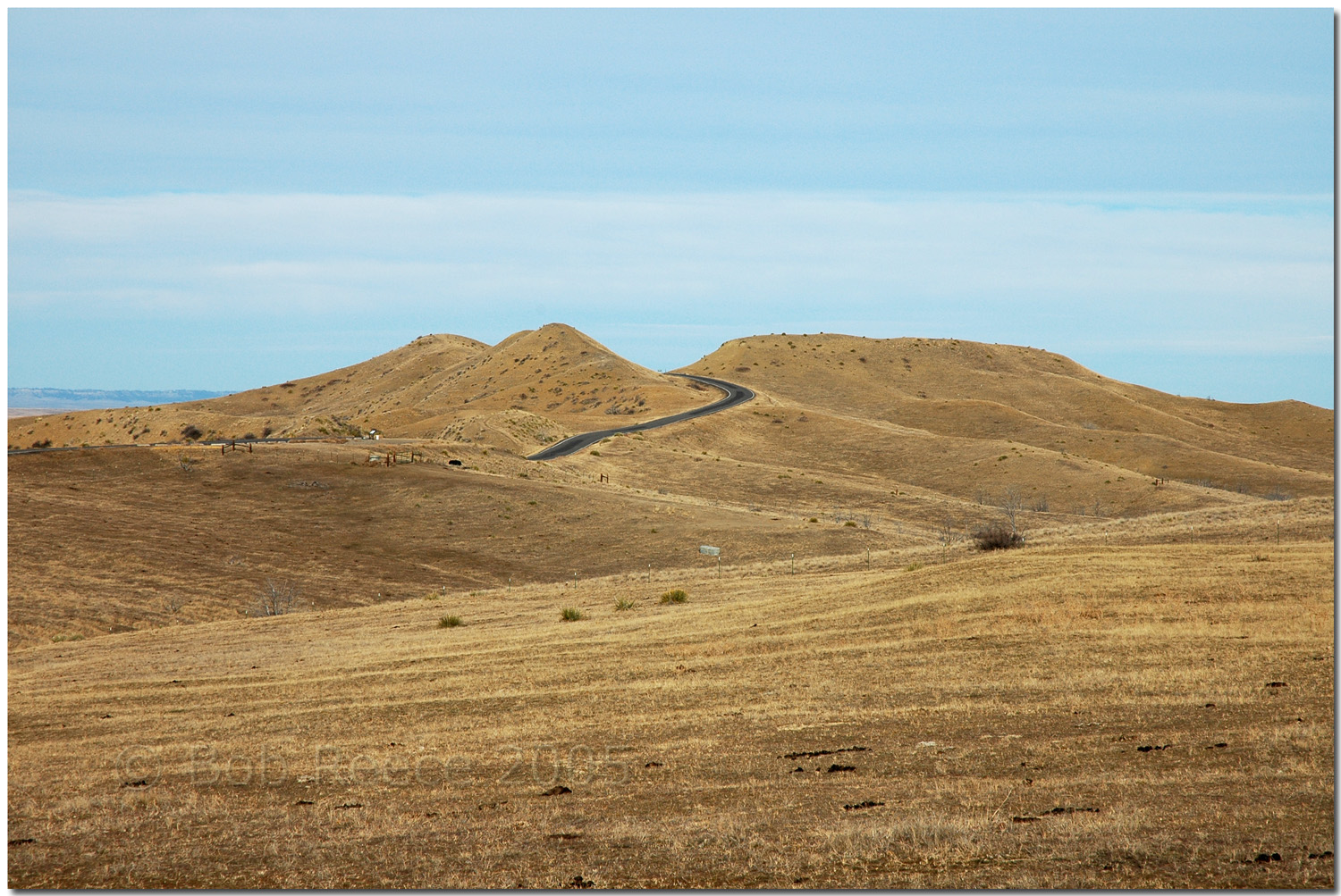 Interesting question. You can point out the highest hill, but........... is it the highest hill? |
|
|
|
Post by johnson1941 on Nov 5, 2023 7:09:20 GMT -6
Lets stop wasting my time, P-Shop.
YOU keep struggling by ignoring the witnesses who were there, and the period maps and pictures, and I'll keep ignoring nonsense...
|
|
|
|
Post by herosrest on Nov 5, 2023 8:08:51 GMT -6
Hmmm............. It's Crimbo.......  You're just making it all up by picking what suits you. I mentioned '5 & 9' on the RCoI evidence item, as linked above. |
|
|
|
Post by herosrest on Nov 5, 2023 8:11:59 GMT -6
5. Hare's estimate of Reno's position, in his advance toward Custer.
9. Edgerley's estimate of point of Reno's advance.
You didn't really even skirt around that information, did you - just blathered it away.
Ah well, added.
6. Hare's estimate of Weir's advance point. Weir knew as well as Edgerley where they went. So, which of them was called first, I wonder.... hang on a minute.
Hare was 8th to be questioned whilst Edgerley went in at 15. So Edgerley had Weir's data infront of him on the map, when he made his conflicting contribution. Seems to me that we have a problemo, Houston!
Worry not, the entire inquiry is problemo.
So, an interpretation of the map as Hare and Edgerley, each interpretted the map may or may not help or we could just accept evidence given as fact and have an outstanding dichotomy develop. I will point out that Hare rode to Maguire's B, during his time at LBH, and that that lends some credence to what he marked on the map.
Why are there what I refer to as the Two Fingers ravines on Maguire's map? What are they and how do they relate the terrain? It's all rather odd, is it not - once settled down studying the Maguire map's penmanship.
|
|
|
|
Post by herosrest on Nov 5, 2023 8:38:09 GMT -6
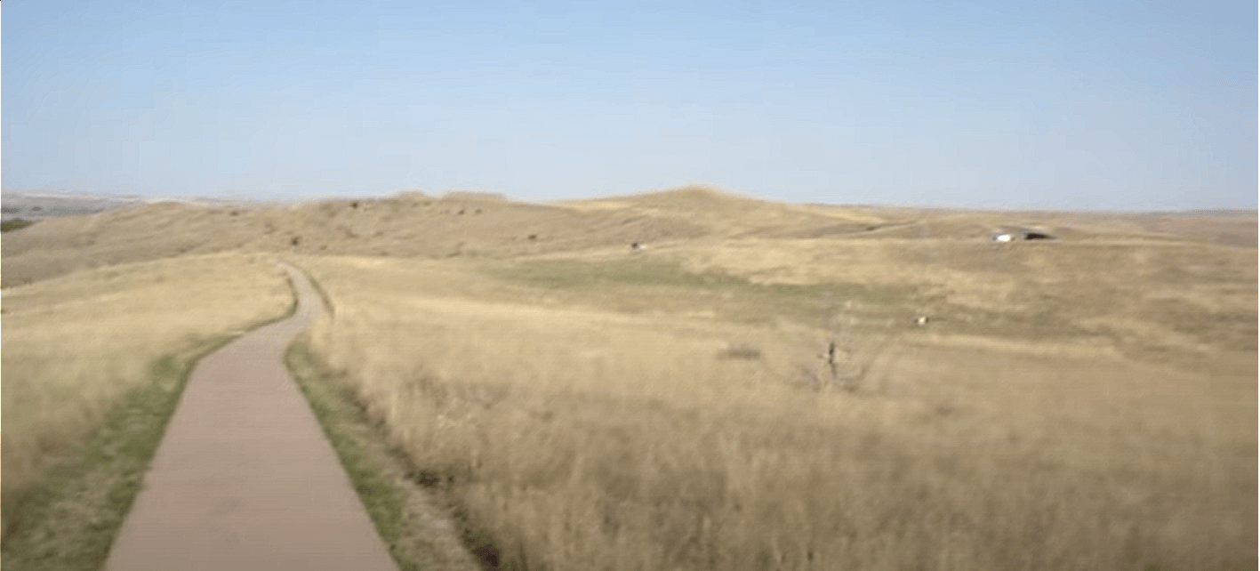
Ok, noog.... then how about we discuss point '2' as indicated by Girard? His estimate of Custer's position when Reno reached hill in retreat.  That is just about where you present Martin's Weir Hill. This is completely the White Man Runs Him rubbish foisted on Curtis and complete bunkem. So is that actual presentation of Girard's evidence. A complete misrepresentation of the testimony. Yet, there are those of particular purile ilk that consider courtroom testimony as handed from on high by deity. That model though begs the question why would a judge or president be needed to chair proceedings. Walk in. Tell the truth. Bingo..... bango, bongo. Case tried. Nail them all tocrossses but let the little one go free to warn others. Good Lord, that looks high! 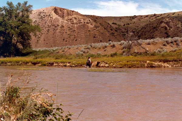 Can we see the highest here link. Or is it Weir. Or even Hare. Hi ho.......................... 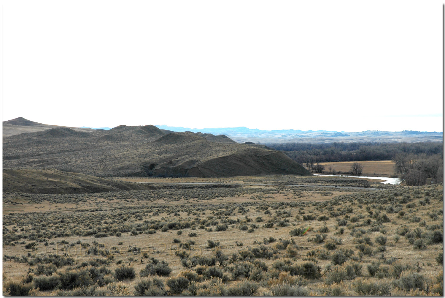 Is Weir Point in this image? |
|
|
|
Post by herosrest on Nov 5, 2023 8:59:55 GMT -6
You will probably adore this one. link Yup............ that's pretty high. Way up................ Good Lord. Look at that swale flanking Horizon Ridge.... I'll bet you there's a horse shoe or two along that route over private lands.  Boooo.......... Is Weir Point in this image? |
|
|
|
Post by herosrest on Nov 5, 2023 9:26:06 GMT -6
|
|
|
|
Post by johnson1941 on Nov 5, 2023 11:06:50 GMT -6
Hmmm............. It's Crimbo....... You're just making it all up by picking what suits you. I mentioned '5 & 9' on the RCoI evidence item, as linked above.  You know ALL about that, PShop. Meanwhile - in the actual exhibit... Go figure - Hare's highest point 5 and DeRudio & Martin's Highest point 7 aka Weir's Hill are right near each other....even on that crappy map. Both by all witness descriptions are 1/2 mile above Edgerly peaks. Ah well...more nonsense. Cause I KNOW you saw this already. 'A smudge' - wow. So this is what it has come to. Photoshop and "smudges". Is learning what actually happened that painful?!? Sad.   |
|
|
|
Post by herosrest on Nov 5, 2023 11:36:40 GMT -6
I don't accept the '5' is squeezed between the '7' & '9'. It is a hill, drawn as so and possibly smudged. But the issue remains the highest point.
I have gone to Varnum for a number of matters being discussed at the moment, and to his July 4th letter home. The Custer Myth: Colonel W.A. Graham, 1953, p342 - 343.
Camp on the Yellowstone, July 4, 1876.
Dear Father and Mother:
Having an opportunity of sending off a letter this evening, I will try and give you an account of our operations since I wrote you last. On the 22d of June General Custer took the entire regiment, numbering about 605 strong, with my squad of about thirty-six scouts and guides, interpreters, etc., and started up the Rosebud river after the Indians, whose trail was discovered by Major Reno. We made about twelve miles the first day and thirty-two or three on the second, and early on the morning of the third day we got on a very heavy trail going up the Rosebud. About ten miles from camp we found a circle surrounded by a brush fence arranged for a sun-dance, a description of which I have given you before, for making warriors. We found a stick with a fresh scalp attached and the trail of two or three Indians, evidently made that morning. We marched twenty miles, and then I was sent back six to examine a creek to see if any Indians had left the trail, and on my return we started again and made eight miles more, and camped in an Indian camp about two days old. The signs indicated an immense force, and we were in a hurry to take them by surprise. Custer came over to see the scouts. Six Crows with us, who knew the country well, said that the trail from here led on towards the Little Horn, a fork of the Bighorn, and they wanted to go ahead about twenty miles to a high bluff from which the valley of the Little Horn could be seen. Custer wanted some intelligent white man to go ahead with them to send him information. I took the six Crows, five Rees, and a white man, who was an old frontiersman, and we marched all night, making about sixty miles. I had rode without rest or any sleep for thirty-six hours. Custer said he would start at 11 pm, and come somewhere near us by morning. At 2:30 o'clock we reached the hill, and lay there in scrub bushes until daybreak, when we discovered the smoke of a village, and by 5 am, I started the Rees back with a dispatch to General Custer. The Crows said there were about two or three thousand ponies on the plain twelve miles off, but I could not see them, as their eyes were better than mine. Custer had come ahead, and we could see his camp about eight miles off. He got my dispatch at 8 am, and started again and came to the hill. In the meantime two Sioux were seen going in the direction of Custer's column. Charley Reynolds, myself, the Crow interpreter and two Crows started out to kill them, and prevent Custer being discovered. We failed to do it, however, and when Custer came up we informed him of the state of affairs, and he concluded, as we were discovered, to hurry up and strike them as soon as possible.
At about 2:30 we came up to the neighborhood of the camp, and three companies, A, G and M, under Major Reno, started in. I saw them going, and Lieutenant Hare, who had been ordered to report to me for duty with our scouts, went in with them. They pretended to run away and we charged up the valley, near the village, dismounted, put our horses in the timber near the stream, and fought on foot. My scouts scattered about so I had no command near me, and I reported to Captain Moylan for duty with Company A. In half an hour we were not only surrounded, but the odds against us were so fearful that we were obliged to retreat, and we returned up into the woods and started on a run for the bluff. The Indians did not press us very hard, and we knew from the fearful firing at the other end of the village that some one was getting it hot and heavy up there. On the bluff we reorganized, and found that Lieutenant McIntosh and DeRudio were gone, and Lieutenant Hodgson was killed close by. Only five men and Lieutenant Wallace came out with company G, and more than one-third of our command was gone. Just then Colonel Benteen and three companies came in from a trip they had endeavored to make to the rear of the village, and the pack-train came up with one company more. This gave us four full companies with the remains of three others and the citizen portion, numbering in all about three hundred men. We could hear heavy firing about two miles off, and knew that Custer, with the remaining five companies, was having a hard fight beyond the village. As soon as we could get into any sort of shape we started along the bluff to try and unite with Custer, and after a mile's march we could see no sign of him; while the firing was very distant. As we were encumbered with wounded and had the whole packtrain on our hands, and hundreds of Indians were turning their attention to us, we selected a good place for defence on the bluffs, and prepared to receive them. The place was well selected, while the horses were in a sort of hollow where they could be shot at from only one direction, and here the ball opened.
We fought, God and ourselves only know how hard, until about 9 o'clock, and then the firing ceased until the first streak of daylight, when the ball opened again. We fortified as much as the four spades we had would let us, and all day long they piled lead into us at a fearful rate. The men fell fast, but young boys soon became old men, and men lay in the trench beside corpses with flies and maggots, and struck and fought like old veterans of years' standing. The hospital held about forty wounded, but was protected by the mules and horses which surrounded it, and which must be hit before the bullets could hit the men. I will not attempt to describe the horror of the situation. We had no water, and the men became furious, and detachments were sent under heavy fire to try and get some. Many were killed and wounded in that way. The horses suffered fearfully, as they, of course, got no water, and could not eat what oats we had without. The firing ceased on the afternoon of the 26th, and we could see that the village was leaving. After dark we changed our camp a little, so as to get away from the stench of the dead animals. In the morning the Indians were gone, and the cause was soon explained. General Terry, with five companies of the Seventh Infantry, and four of the Second Cavalry, was coming to our relief. They had seen the Crow scouts, who had escaped, and hurried to our assistance. They reached us about 10am, and then the sickening details were seen in all their horror. General Custer, with his five companies, had been exterminated. About three hundred men had been killed, and their bodies stripped and horribly mangled. Sixteen officers had fallen, viz: General Custer, Captain Keogh, Captain Yates, Captain Custer, Lieutenant Cooke, First Lieutenants Smith, McIntosh, Calhoun and Porter; Second Lieutenants Hodgson, Harrington, Sturgis and Reilly, of the Seventh Cavalry, Lieutenant Crittendon of the Twentieth Infantry; Doctors Lord and DeWolf. Colonel Benteen and myself were slightly wounded.
I have received two slight flesh wounds, one in each leg, below the knee, while charging, dismounted, to drive the Indians from a hill where they were killing our men very rapidly.
It seems horrible to think it all over now. Mrs. Custer loses her husband and his two brothers - one a citizen travelling with us, and Mrs. Calhoun loses her husband and three brothers (She is the General's sister), and a nephew - a Mr. Reed travelling with us also. Half of the officers with us are killed, and the regiment sadly cut up. I will give you some more of the incidents hereafter. I have been put in command of the remnant of Company I. This makes me a First Lieutenant, and No. 11 on that list. We are encamped on our old battle ground of August 11, 1873, and a boat has gone to Lincoln to open communication with Sheridan, and receive orders. When we got a mail yesterday by a carrier from Fort Ellis, we received a letter from Sheridan, a month old, cautioning Terry not to split his command, as he had information that at least five thousand warriors were assembled, and I don't think there is any doubt but that we fought four thousand of them. Gen. Crook, with sixteen companies of cavalry, was coming up from the south, and this despatch says he has been reinforced by the whole Fifth Cavalry, giving him twenty-eight companies to fight what we struck with twelve. This is a brief account of affairs. Don't worry for me.
Your affectionate son,
CHARLES A. VARNUMThey charged a hill. Obviously it was a high hill. Was it the highest hill?
|
|
|
|
Post by johnson1941 on Nov 5, 2023 13:43:15 GMT -6
Sucks for you - you will never learn what really happened if you always choose to struggle against the facts.
Is that all?!?
Well THAT is SO easy!...
Various
I claim that what is called Weir’s Hill is the highest point on the ridge in that vicinity
To that highest point, Weir’s Hill, probably half a mile down
beyond Major Reno’s position on the hill, about half a mile…from the point we called Weir’s Hil
Custer saw the camp from the highest point on the ridge to the right of the first intrenchment
He was going to that highest point when I went away
one nearer the river and the highest point on that side. Where I saw General Custer the river comes right under the bluff
came to the highest point of the bluff and waved their hats and made motions like they were cheering
It was on the highest point on the right bank of the creek, just below where Dr. DeWolf was killed.
it could not have been more than 5 or 600 yards. It was a higher point but lower down on the river
I planted a guidon at the highest point that looked over that country
the furthest point reached by any company under Major Reno was about half a mile below that highest point
It was the highest point around there. I went on the top of it afterwards, on the 27th, with Captain Benteen
Custer first halted on Weir‘s hill and took a look at village
It was the highest hill the very highest point around there
a guidon being placed at a point termed Captain Weir’s hill…it was done
This guidon…where was it planted…On the top of the highest hill
at that highest point ...I saw no such evidence of fighting nor heard any firing
the highest point down the river below where Major Reno made his stand
the command started down a ravine to get off the bluff, somewhat to the right of highest ground
He did after we had reached that highest point at the figure “7”
The highest point...in a straight line...between these two points, I should think, is in the neighborhood of 150 feet.
General Custer, Lieutenant Cooke and another man I could not recognize came to the highest point of the bluff
We moved out along the ridge, the highest point, that point “7”
Indians whom we had already seen from the highest point
To highest point, about 3/4 mile north of place of fortifcation
after the highest point on the bluffs was reached the men, through their eagerness, broke into something like disorder
No matter how many pictures you post of Edgerly peaks, they are never going to get any higher than Weir’s Hill was c1876-1879. They are never gonna move 1/2+ mile south to where the river is tight.
The primary statements will never change & they all corroborate the fact...
Weir’s Hill aka the highest point that point 7 was THE highest point.
We’re done here.
PS - 'the high point from which the indians fired on Reno Corral from the north was 600' from the edge of the bluff...just about where Reno retreated up'
You're welcome.
|
|
|
|
Post by herosrest on Nov 14, 2023 14:11:20 GMT -6
So, i.imgur.com/91oU72U.jpg whilst you are dealing pin point precision rhetoric based in re=assessment of work undertaken beginning thirty years after the battle by a railway engineer whose work you still do not understand for what it is, there is only one highest hill. It is the highest hill because it was and still is the highest there. Anyone, and everyone can see it but you want it to be something else and in a place where it seemed like the highest hill. Was Weir's highest Hill, Martin's highest hill. Since Weir left Martin's highest hill to go and see what lay beyond Horizon Ridge downriver, Martin's Weir Hill could not possibly be Weir's Weir Hill or the Peaks behind which Edgerley's led horses were placed for safety. Further, if we take onboard Hare's 5 & 5 at RCoI, which seem to bring you some consternations, then note their relationship to the maps 'B' and what is now called Medicine Tail Ck. Isn't that remarkable. If you can show that WMC met Edgerley, or sent him a map which he returned all nicely marked up and precisely explaining precisely where the terrain features were, then you rely entirely upon WMC's work, which despite shedding much light through the numerous notes and letters, is riddled with the muddle that you have decided make complete sense. In correcting my very clever 100' error with height, you destroyed your own argument and no, a hill did not fall down and nor was it demolished. Thanks, yuo better, and golly wow. |
|
|
|
Post by herosrest on Nov 14, 2023 17:46:53 GMT -6
We have the MAP. The Chicago Grail which WMC never saw and thus never understood. babel.hathitrust.org/cgi/pt?id=mdp.39015001146235&seq=6&view=1upLinked blob:https://babel.hathitrust.org/656a5b0a-6b6a-457c-b579-2e49f5f0f9dd is the original document with B56 and those who are able or have studied the related text know that Hare described the river at 'B'. He was able to do so because he went there. Therefore have fun explaining why you think 5 & 6 actually are where you want them to be. Please note also that in 1877, in the field, Lt. Hare was 7th Cavalry's EO and I jave read his reports. So, he wasn't confused by Engineering maps of recon and marches. There's quite more to come but you should explain Hare's 5 & 6 rather than pulling further silly stunts. Yes, silly stunts. I can't wait.  |
|


 That is just about where you present Martin's Weir Hill.
 Boooo.......... Is Weir Point in this