|
|
Post by johnson1941 on Aug 25, 2024 9:38:07 GMT -6
Dan, Knowing Deep Ravine is almost due south of Custer, i have marked what I think is Deep Ravine in yellow. Also note the creek across the river from its joining with LBH. Cemetery ravine would be just northwest of that. In red.  Note the N true meridian mark down in the lower right corner. |
|
|
|
Post by herosrest on Aug 25, 2024 10:00:29 GMT -6
One of the battle's less well known books and event, is link Philetus P. Norris's account of his visit to the battlefield in early July 1877, with a photographer. Norris was then the newly appointed Superintendent of Yellowstone Park, and making his way there. Doug D. Scott did some research o Norris because there is record that he recovered a hundred or so  spent cartridge cases from Custer Hill. Interestingly, a wagon train which arrived opposite the battlefield in August 1877, visited also, and recovered relics from the field. Anyway..... oh yeah; Norris was there, of course and whilst his original map went missing, he put the one linked together when his book went to print. He added the slough or moat in the village area, and bayou upriver in rear of Reno's halt. Duting the visit, he used a sketch provided by Herendeen, to locate Charley Reynold's remains and take them with him to Yellowstone. Well, some of them. Norris noted various features of the terrain and body positions, and you will notice the considerable number of '4's indicating 'impassable coules'. Isn't that odd. Unfortunately, Norris's book is scatterbrained but full of important snippets about the battle, and imagine him being thir with a photographer. Whatever next. |
|
|
|
Post by lakotadan on Aug 25, 2024 10:21:30 GMT -6
Thanks, johnson1941 for your markups! I am so confused by these different maps! I have included Wilson’s map with markups of where I think the Cemetery Ridge ravine is (mostly in blue), the Deep Ravine is (mostly in red) and the offshoots of those ravines (circled in black). I also added a basin or bowl feature (a black circle) that could have connected those other black offshoots of the ravines and formed a ravine or gulch below Last Stand Hill (behind a small hill). I also attached a map from Maguire that shows (in blue) an offshoot of the Cemetery Ridge Ravine (as in the Wilson map circled in black on the Cemetery Ridge Ravine) that is the area marked “H” on Maguire’s map. I don’t know how accurate those maps were made in those days! I think that using any of the maps made probably within 25 years of the battle leaves a lot to be desired! Anyway, I am still on the Forgotten Gulch thing! Even if it may turn out to be a "wild goose chase", I have learned a lot! Attachments:

|
|
|
|
Post by herosrest on Aug 25, 2024 10:25:04 GMT -6
Adventures with Indians and game, or, Twenty years in the Rocky Mountains by Allen, William Alonzo Doc. Allen in LBH valley, August 1877. ' Page 68
We started early, determined to make 'the rounds of the dead line occupied by the enemy. On the edge of Dry Creek, on the ridge and in the coulee, we found thousands of cartridge shells lying in piles, each pile showing clearly where each warrior was situated. From these points almost the whole battlefield could be seen, and t.............. William A. Allen. |
|
|
|
Post by herosrest on Aug 27, 2024 6:14:51 GMT -6
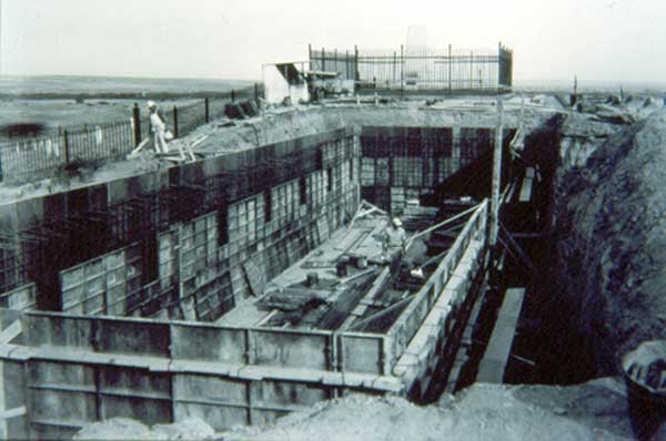
Hi Dan, I bumped intp this item link This postcard captures the beauty of Custer Battlefield National Cemetery in Garryowen, Montana. The image depicts a monument in the cemetery and showcases the natural beauty of the region. It blows up rather well. Don't use C4. I've got it up to 9100 x 3100 px but just the top half showing the ridge. What it shows is the grading done to construct the road. You can see the fressh infill on which the road was raised to run above the water flow from rain and floods. It was raised quite a bit above the hils and gullies as it ran down to Calhoun Hill. www.friendslittlebighorn.com/little-bighorn-changing-faces.htm |
|


 spent cartridge cases from Custer Hill. Interestingly, a wagon train which arrived opposite the battlefield in August 1877, visited also, and recovered relics from the field. Anyway..... oh yeah; Norris was there, of course and whilst his original map went missing, he put the one linked together when his book went to print. He added the slough or moat in the village area, and bayou upriver in rear of Reno's halt. Duting the visit, he used a sketch provided by Herendeen, to locate Charley Reynold's remains and take them with him to Yellowstone. Well, some of them.