Post by herosrest on Jun 11, 2012 14:58:05 GMT -6
Lt. Maguire's conclusions related to Custer's fight at Little Big Horn were based on the position of the dead. An attempted crossing at Ford B met overpowering force which brought retreat. A column which retreated from Ford B towards Deep Ravine and Last Stand Hill, did so dismounted, fighting along the whole distance. From Deep Ravine to Custer Hill stretched a line of dead men at skirmish intervals. In essence, Maguire felt the command retired along two lines marked on his sketch to concentrate at Custer Hill, moving away from the Regiments left wing and packtrain, reserves and rear guard. He did not speculate why such maneuver should be necessary or imposed on the command.
Similar information was noted by Capt. Henry B. Freeman, who indicated two lines of march or a circuit over the terrain. Both officer's indicated the camping site extending significantly downstream of its actual layout when 7th Cavalry attacked. Freeman was aware of the actual layout and knew that; "On the evening of the 25, the Indians moved the upper part of the village down about 2 miles and settled down again." He indicated two fords, Ford B and another downstream in the lower camp. Medicine Tale Creek is shown and the first bodies found are indicated across from Ford B, suggesting his approach was from upriver. Besides fords and Medicine Tale Creek, the most striking terrain is the mouth of Deep Coulee which stretches away towards Calhoun Hill.
Freeman indicated trails of shod horses, Maguire did not.
A number of theories developed from military sources as to what took place, and commonly refer to maneuver either Clockwise or anti-clockwise about the field of battle. Later and modern research has developed the battle understood today. There were differences of opinion between officers from immediately after the battle, and that between Godfrey and Varnum of 7th Cavalry resolved in favour of Godfrey with acceptance that Custer's command followed a circuitous route into and beyond Medicine Tail Creek, where the companies divided strength. Scientific evidence for this occuring is sparse but a momentum of opinion holds sway in the matter.
As everyone today knows or is told, Custer halted in Upper Medicine Tail Coulee and companies progressed towards the river at the its mouth. The remainder of the command moved along ridges to the north in attempt to ford the Little Bighorn and attack the north end of the village. The concept is rooted in a disagreement between Varnum who could not have seen companies follow that route, and Godfrey who didn't have clue what took place moreso than any other, except a handful of survivors who rode with Custer's advance.
The idea of the command splitting took hold early, as evidenced by Lt. Maguire and Capt. Freeman. It was also the view of both Maj. Reno and Capt. Benteen, who indicated a rapid advance by Custer's men and combat and retreat by detachment from the river. Gen. Terry believed the troops, 'diverged from the bank of the river after attempt to cross and almost completing a circle marked by remains of officers, men and the bodies of horses, some strewn along the path, others heaped where halts appeared to have been made.
Reno felt that although the trail showed he had moved rapidly, they were ready; Companies C and I, and perhaps part of E, crossed to the village or attempted it; at the charge were met by a staggering fire and fell back followed too closely to permit any kind of line.' Benteen was of opinion that nearly if not all of companies got into the village, were driven out immediately in disorder and crossing two instead of the one ford by which they entered. E Company going by the left and F, I, and L by the one they crossed. What became of C Company is not known as very few of their horses were found. After the indians had driven them across, it was a regular buffalo hunt for them and not a man escaped.'
By 1892 Godfrey had developed belief imparted to him by Gall, that the companies were never near the river and the dead bodies of soldiers on the river's bank had fled, crossed the river lower down, were chased up stream toward the village, driven back into the river and killed. 'Custer's Last Battle' was widely received and Godfrey marked as the Battle's leading expert. His map indicates a route towards Calhoun Hill and Battle Ridge which ignores Blummer's or Nye Cartwright Ridge and Luce Ridge as scenes of the fighting. This is odd and Godfrey's take on the thing was questioned and investigated by Walter M. Camp, who understood perfectly well that troopers did approach the river. Godfrey however managed to hold sway over Varnum, and today the use of Cedar Coulee as the line of march pays tribute to his influence over the battle's history.
Gall did not join the Custer fight until the retreat stage was obviously well underway, and therefore could not tell of the earlier period of fighting near the river. Godfrey accepted Gall's honesty as the entire story and today we have the Godfrey disaster. A gray indian pony was recovered from Custer battlefield, found beyond the high ridge on which the stage route ran to Busby. He was in a coulee tied to a tree with a bunch of grass in his mouth tied to bit and had evidently been tied there since June 25th. The horse was found and kept by Lieutenant Edward S.Godfrey commanding Company K, who rode and got attached to it. The animal was killed under him at Bear Paw Mountain, shot out from under him. At the 10th Anniversary Gall showed Godfrey over the battleground, and it was then Godfrey remembered a faint trail seen ten years earlier which became the his route followed by Custer. Marquis supported Godfrey's theory in the research associated with Wooden Leg's story. Finds of cartridges on Blummer's Ridge during the 1920's were brought to attention by Marquis.
It is obvious from Capt. Freeman's sketch, that '4' must be Blummer's or Nye Cartwright Ridge, where he noted 'there were indications that they had dismounted and made a stand'. There is no other way to orientate terrain at '4', to Deep Coulee.
No account from any participant in the battle places Custer's men in Cedar Coulee, the opposite is true. The idea has materialised over time in very odd fashion from wishful thinking that cannot be shown true. What can be shown since Capt. Freeman and Lt. Maguire put pencil to paper, June 1876, is where the command did seperate. At Ford B on the mouth of Medicine Tale Creek. It was not Custer's command in Cedar Coulee, since those who marched and survived, did not mention the command seperating until Medicine Tale Creek.
An interesting state of affairs - there is no-one able to prove conclusively that Custer's command used that route, unless as confused as those taking Lt. Maguire's report of July 10th 1876, to indicate that Reno and Custer's commands arrived near the village at 2pm, on the 25th June. Maguire was Terry's Engineer Officer, Freeman was Gibbon's senior captain, an experienced, able hero, the measure of any officer present.
To James McLaughlin (My Friend the Indian), Gall said that when he reached the lower end of the village Custer was still some distance off; his force advancing irregularly, but not straggling far. While the column was still silhouetted against the sky line of the ridge, Crazy Horse with the Cheyennes crossed the river, and, under cover of the inner ridge, made their way into the ravine to the north and west of the ridge upon which Custer was advancing. This is a very different kettle of fish, to views that Gall saw Custer from east of the river towards Reno Hill.
Gall threw many of his people across the river, the Hunkpapas, Minniconjous, Oglalas, Sans Arcs, and Brules crossing in a swarm, some being sheltered from the sight of Custer by the lower ridge, others making their way around the ravine. They were all hidden from the view of the command. Holding steadily to what appeared to be his original plan of attack, Custer swung his troops to the left from the ridge, and turned down to the river. As the men rode down into the bottom, the Indians saw that they were apprehensive, but they did not falter and they were well down to the stream before the Sioux showed themselves on that shore. Of course, the lower end of the village had been in sight occasionally for some time, but it was unlikely that Custer could have known that the Indians had crossed the river to meet him.
An assumption is that Gall was seeing Custer's first approach to the river, as he swung his troops to the left from the ridge, and turned down to the river. The location of the lower end of the village, where Gall was, is known but Custer was descending Deep Coulee and silhouetted against the sky line of the ridge. Crazy Horse with the Cheyennes crossed the river towards Custer, but everyone apparently knows that Crazy Horse had attacked Reno's command. So where was Custer coming from?
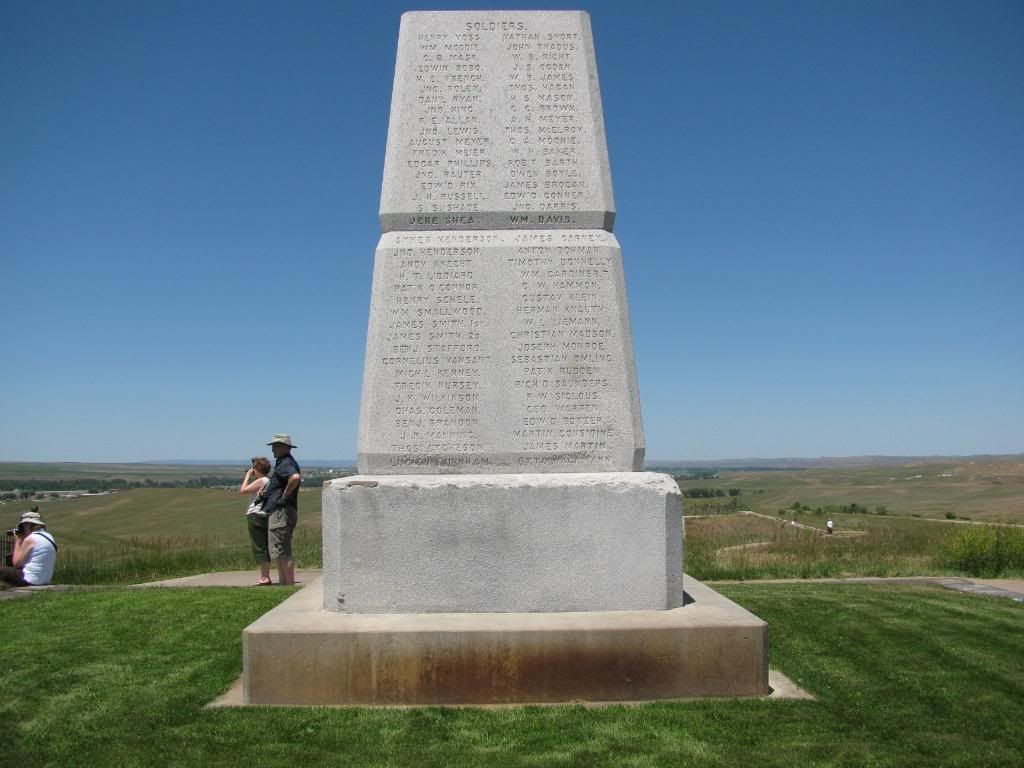
The Cheyennes Yellow Nose and Low Dog, were first to cross the river and rode back in front of the soldiers, firing at them. This slowed down Custer's advance. More warriors joined them and the soldiers began pulling back, moving toward the river across from the Cheyenne camp where warriors concealed in brush along the river bottom fired out at the cavalrymen. The soldiers turned north, riding back in the direction from which they had first come until they reached the place where the cemetary is located today and made a long pause. So which cemetary is referred to? We ask Peter Powell...... or John Stands in Timber, but I doubt they ever actually knew - neither being born when the battle was fought, and there having been several cemetaries of which Custer's Battleground was one. How many times were burial details over that cemetary before the remains were all sepulchered beneath the stone obelisk. The battleground was the cemetary.
Similar information was noted by Capt. Henry B. Freeman, who indicated two lines of march or a circuit over the terrain. Both officer's indicated the camping site extending significantly downstream of its actual layout when 7th Cavalry attacked. Freeman was aware of the actual layout and knew that; "On the evening of the 25, the Indians moved the upper part of the village down about 2 miles and settled down again." He indicated two fords, Ford B and another downstream in the lower camp. Medicine Tale Creek is shown and the first bodies found are indicated across from Ford B, suggesting his approach was from upriver. Besides fords and Medicine Tale Creek, the most striking terrain is the mouth of Deep Coulee which stretches away towards Calhoun Hill.
Freeman indicated trails of shod horses, Maguire did not.
A number of theories developed from military sources as to what took place, and commonly refer to maneuver either Clockwise or anti-clockwise about the field of battle. Later and modern research has developed the battle understood today. There were differences of opinion between officers from immediately after the battle, and that between Godfrey and Varnum of 7th Cavalry resolved in favour of Godfrey with acceptance that Custer's command followed a circuitous route into and beyond Medicine Tail Creek, where the companies divided strength. Scientific evidence for this occuring is sparse but a momentum of opinion holds sway in the matter.
As everyone today knows or is told, Custer halted in Upper Medicine Tail Coulee and companies progressed towards the river at the its mouth. The remainder of the command moved along ridges to the north in attempt to ford the Little Bighorn and attack the north end of the village. The concept is rooted in a disagreement between Varnum who could not have seen companies follow that route, and Godfrey who didn't have clue what took place moreso than any other, except a handful of survivors who rode with Custer's advance.
The idea of the command splitting took hold early, as evidenced by Lt. Maguire and Capt. Freeman. It was also the view of both Maj. Reno and Capt. Benteen, who indicated a rapid advance by Custer's men and combat and retreat by detachment from the river. Gen. Terry believed the troops, 'diverged from the bank of the river after attempt to cross and almost completing a circle marked by remains of officers, men and the bodies of horses, some strewn along the path, others heaped where halts appeared to have been made.
Reno felt that although the trail showed he had moved rapidly, they were ready; Companies C and I, and perhaps part of E, crossed to the village or attempted it; at the charge were met by a staggering fire and fell back followed too closely to permit any kind of line.' Benteen was of opinion that nearly if not all of companies got into the village, were driven out immediately in disorder and crossing two instead of the one ford by which they entered. E Company going by the left and F, I, and L by the one they crossed. What became of C Company is not known as very few of their horses were found. After the indians had driven them across, it was a regular buffalo hunt for them and not a man escaped.'
By 1892 Godfrey had developed belief imparted to him by Gall, that the companies were never near the river and the dead bodies of soldiers on the river's bank had fled, crossed the river lower down, were chased up stream toward the village, driven back into the river and killed. 'Custer's Last Battle' was widely received and Godfrey marked as the Battle's leading expert. His map indicates a route towards Calhoun Hill and Battle Ridge which ignores Blummer's or Nye Cartwright Ridge and Luce Ridge as scenes of the fighting. This is odd and Godfrey's take on the thing was questioned and investigated by Walter M. Camp, who understood perfectly well that troopers did approach the river. Godfrey however managed to hold sway over Varnum, and today the use of Cedar Coulee as the line of march pays tribute to his influence over the battle's history.
Gall did not join the Custer fight until the retreat stage was obviously well underway, and therefore could not tell of the earlier period of fighting near the river. Godfrey accepted Gall's honesty as the entire story and today we have the Godfrey disaster. A gray indian pony was recovered from Custer battlefield, found beyond the high ridge on which the stage route ran to Busby. He was in a coulee tied to a tree with a bunch of grass in his mouth tied to bit and had evidently been tied there since June 25th. The horse was found and kept by Lieutenant Edward S.Godfrey commanding Company K, who rode and got attached to it. The animal was killed under him at Bear Paw Mountain, shot out from under him. At the 10th Anniversary Gall showed Godfrey over the battleground, and it was then Godfrey remembered a faint trail seen ten years earlier which became the his route followed by Custer. Marquis supported Godfrey's theory in the research associated with Wooden Leg's story. Finds of cartridges on Blummer's Ridge during the 1920's were brought to attention by Marquis.
It is obvious from Capt. Freeman's sketch, that '4' must be Blummer's or Nye Cartwright Ridge, where he noted 'there were indications that they had dismounted and made a stand'. There is no other way to orientate terrain at '4', to Deep Coulee.
No account from any participant in the battle places Custer's men in Cedar Coulee, the opposite is true. The idea has materialised over time in very odd fashion from wishful thinking that cannot be shown true. What can be shown since Capt. Freeman and Lt. Maguire put pencil to paper, June 1876, is where the command did seperate. At Ford B on the mouth of Medicine Tale Creek. It was not Custer's command in Cedar Coulee, since those who marched and survived, did not mention the command seperating until Medicine Tale Creek.
An interesting state of affairs - there is no-one able to prove conclusively that Custer's command used that route, unless as confused as those taking Lt. Maguire's report of July 10th 1876, to indicate that Reno and Custer's commands arrived near the village at 2pm, on the 25th June. Maguire was Terry's Engineer Officer, Freeman was Gibbon's senior captain, an experienced, able hero, the measure of any officer present.
To James McLaughlin (My Friend the Indian), Gall said that when he reached the lower end of the village Custer was still some distance off; his force advancing irregularly, but not straggling far. While the column was still silhouetted against the sky line of the ridge, Crazy Horse with the Cheyennes crossed the river, and, under cover of the inner ridge, made their way into the ravine to the north and west of the ridge upon which Custer was advancing. This is a very different kettle of fish, to views that Gall saw Custer from east of the river towards Reno Hill.
Gall threw many of his people across the river, the Hunkpapas, Minniconjous, Oglalas, Sans Arcs, and Brules crossing in a swarm, some being sheltered from the sight of Custer by the lower ridge, others making their way around the ravine. They were all hidden from the view of the command. Holding steadily to what appeared to be his original plan of attack, Custer swung his troops to the left from the ridge, and turned down to the river. As the men rode down into the bottom, the Indians saw that they were apprehensive, but they did not falter and they were well down to the stream before the Sioux showed themselves on that shore. Of course, the lower end of the village had been in sight occasionally for some time, but it was unlikely that Custer could have known that the Indians had crossed the river to meet him.
An assumption is that Gall was seeing Custer's first approach to the river, as he swung his troops to the left from the ridge, and turned down to the river. The location of the lower end of the village, where Gall was, is known but Custer was descending Deep Coulee and silhouetted against the sky line of the ridge. Crazy Horse with the Cheyennes crossed the river towards Custer, but everyone apparently knows that Crazy Horse had attacked Reno's command. So where was Custer coming from?
The Cheyennes Yellow Nose and Low Dog, were first to cross the river and rode back in front of the soldiers, firing at them. This slowed down Custer's advance. More warriors joined them and the soldiers began pulling back, moving toward the river across from the Cheyenne camp where warriors concealed in brush along the river bottom fired out at the cavalrymen. The soldiers turned north, riding back in the direction from which they had first come until they reached the place where the cemetary is located today and made a long pause. So which cemetary is referred to? We ask Peter Powell...... or John Stands in Timber, but I doubt they ever actually knew - neither being born when the battle was fought, and there having been several cemetaries of which Custer's Battleground was one. How many times were burial details over that cemetary before the remains were all sepulchered beneath the stone obelisk. The battleground was the cemetary.