|
|
Post by wild on Aug 27, 2017 0:39:16 GMT -6
Again
The main concentration of shells on the battlefield lies approx 1000 yards to the East of Reno Hill . The line runs North South for approx 1200 yards and contains over 600 Indian shells (non military) .
At a 1000 yards the Indians had no hope of hitting anything. Nor was a single military round found in or near this line.
Thus I think it is safe to say that this line is spurious and the firing here was due to the more involved tourist.
Did this activity occur else where? You betcha it did.
Cheers
RICHARD
|
|
|
|
Post by mac on Aug 27, 2017 3:57:13 GMT -6
The Red Hawk account tells us that at the Calhoun Hill Battle the 3 divisions he observed were pushed back and the remnants fled along both sides of the Battle Ridge and that none of them got back to Last Stand Hill.
This explains why there is the noticeable gap between the last Battle Ridge marker and the first of the markers related to LSH. It also tells us that the 3 divisions he saw were not “pure” companies. They were certainly substantially men from L, C, and I but we know men from each of those companies were left at the Custer Battle when their companies departed. There are many possible reasons for this perhaps even simply the confusion of battle. This is why F Company trooper (William Brown) and HQ trooper (TMP Dose) are found in the south. They returned there in the retrograde from the Custer Battle, probably with the Company C group. This is a far more likely scenario than an appearance at Ford B with no intent to attack.
More later.
Cheers
|
|
|
|
Post by AZ Ranger on Aug 27, 2017 6:39:59 GMT -6
What I see in Scott and Bleed is the possibility that E and F moved through Keogh sector then north along BRE to Ford D and came back across CR. Is that what you think may have occurred? Yes, precisely. Scott and Bleed found artifacts in the Deep Coulee flats leading up to the top of Finley-Finckle Ridge and onto Calhoun Hill. This is consistent with Indian accounts of troop movements. It is also consistent with accounts of troops at Ford B, both with descriptions, i.e., gray horses at the river banks; consistent with bodies found, i.e., an F Company trooper (William Brown) across the river and a HQ trooper (TMP Dose) a couple hundred yards up the Deep Coulee flats. It also jibes with Benteen's killing of a gray horse near the ford. The archaeologists' interpretation of what they found there is also consistent with the Indian accounts, primarily Wooden Leg's. And here is something to chew on: Wooden Leg was there... and he was there as a young warrior; John Stands In Timber was not there and only relates what he was told. He also spoke about most of it in the 1950s and early 1960s, seventy-five years after the fact. Why should JSIT be believed while the accounts of someone who was there discounted? Do you know what Dark Cloud would make of that?So, yes, I believe, firmly, HQ, and companies E and F moved up the Deep Coulee flats, ultimately uniting with Keogh's battalion on Calhoun Hill. And all that can be corroborated by circumstantial artifactual interpretation and Indian accounts. Other than documentary film, it is the best we can hope for. I have no issue with that interpretation... none. My only question is, What makes you think they were troopers from E and F? Why couldn't they have been refugees from C, I, and L?... which I would argue would be more likely. The location on BRE for the 4 carbine matching cases is long walk from LSH. So it could be possible that refugees could move from C,I,L but for me it is more likely following the NPS guys that it would be from Custer (E,F,HQ) moving down BRE and going toward Ford D. Just my thought anyway. I do not see any incompatibility with those two scenarios. Again, JSIT is all hearsay. For example... define Last Stand Hill. Does that include the BRE? How about the SSL? More telling, how about the basin? JSIT was born six years after the battle. All things being equal, I would suggest some 20 years went by before he fully understood the beginnings of Cheyenne lore as it pertained to the battle. By that time, myriad events had taken place, not the least of which was the forced migration down to Indian Territory and back. He was educated in Kansas, raised in three different and differing religions, and spent 50 years collecting stories, articles, documents, and according to Donahue, "powwow programs." Are we to put a lot of stock in "powwow programs"? So while I place confidence in JSIT's veracity, I place less confidence in what he had been told... or discovered. I prefer the first-hand accounts of men like Wooden Leg, regardless of how long after the battle he told some white-eye. I came home from Vietnam 50 years ago; do you doubt my stories or memories? Would I doubt yours? And I can say this: what Wooden Leg observed at the LBH far outdoes what I observed in Vietnam!!!! Getting back to that quote above, why wouldn't that movement-- after we define "Last Stand Hill"-- be referring to Yates' move out of the basin up to LSH? Best wishes, Fred.
The bottom line is that you are at the point where it is a firm in your mind based upon the wealth of research that you have done. That is how it should be in my opinion. New persons don't have the same resources to draw upon and it what keeps things going on these boards. There are lots of people that believe that Custer never went north of LSH and I know you are not one of them. My friends Douglas Scott and Michael Donahue also believe in the movement north of LSH. You are in good company.
Regards
Steve |
|
|
|
Post by AZ Ranger on Aug 27, 2017 6:50:12 GMT -6
Again The main concentration of shells on the battlefield lies approx 1000 yards to the East of Reno Hill . The line runs North South for approx 1200 yards and contains over 600 Indian shells (non military) . At a 1000 yards the Indians had no hope of hitting anything. Nor was a single military round found in or near this line. Thus I think it is safe to say that this line is spurious and the firing here was due to the more involved tourist. Did this activity occur else where? You betcha it did. Cheers RICHARD Richard Haven't you heard the saying where there is lead there is hope? What are you using for your source? What would make you think that tourist would have period correct ammunition? The sites I have seen near LSH have distances up to 800 yards and beyond. No one likes to get hit. Reynolds talks about shooting at an Indian at 900 yards and missing. The reason I ask for the source is check measurements and how the artifacts were placed on the map. Thanks Steve |
|
|
|
Post by wild on Aug 27, 2017 13:28:21 GMT -6
Tourists began visiting the field July 1876 AZ
Source is Mike Bonafede's Archeological map.
And Reno fired at Indians a mile distant with his pistol.
CHEERS
Richard
|
|
|
|
Post by herosrest on Aug 27, 2017 17:54:42 GMT -6
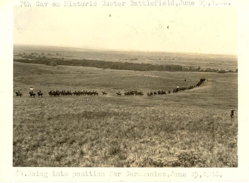
Photographic evidence of 7th Cavalry riding upto and across CR and BR exists and is provided. I guess that Goff was in cummunicado when he accompanied the regiment. It couldn't have been Morrow because he never understood what happened and Haines was then at Ripon. I belieeve that 1876 was just before D.F. Barry was on the scene. Historical source.link |
|
|
|
Post by mac on Aug 27, 2017 20:59:12 GMT -6
Let’s look at the warrior accounts. I have no problem at all with the information in the accounts from the men who were at the Reno fight and therefore were not actually at Ford B. They are simply telling what happened as it was told to them. Custer came down, grey horses dismounted, they left and went to the high ground. The notable thing is the lack of detail about the warrior response. There were not many but they forced Custer away.
Now look at the mainly Cheyenne accounts from Ford D. The same sort of outline of the cavalry action but they tell us that the warriors crossed the river to the same side as Custer. They name some who did this. They report that they were concealed behind a mound and a small ridge and in an old arm of the river. They tell us they were being quickly reinforced by warriors arriving from the village.
The topography they give in the accounts is Ford D not Ford B.
That is why I discount so many reports from primarily Sioux who fought Reno in the valley; they did not see, they heard.
Cheers
|
|
|
|
Post by AZ Ranger on Aug 28, 2017 7:01:13 GMT -6
Tourists began visiting the field July 1876 AZ Source is Mike Bonafede's Archeological map. And Reno fired at Indians a mile distant with his pistol. CHEERS Richard Richard But what you are suggesting is that they were carrying Indian firearms. Do you think that even at the anniversary events they had Indians firing live ammunition? If so offer proof to support your statement. Most contamination from the anniversary and other events are .45-70 cases that are not period correct. You may have a new discovery . That tourist armed with Indian weapon systems were allowed on the battlefield in one particular area and fired on line. Regards Steve |
|
|
|
Post by AZ Ranger on Aug 28, 2017 7:04:05 GMT -6
Photographic evidence of 7th Cavalry riding upto and across CR and BR exists and is provided. I guess that Goff was in cummunicado when he accompanied the regiment. It couldn't have been Morrow because he never understood what happened and Haines was then at Ripon. I belieeve that 1876 was just before D.F. Barry was on the scene. Historical source.linkHR If exist then please show us since that picture does not support both CR and BRE. Thanks BE |
|
|
|
Post by wild on Aug 28, 2017 10:26:15 GMT -6
Hi Az
There is a line of approx 600 non military shells streching north South for over 1000 yards to the East of Reno's position . If this was an Indian position then they were engaging Reno at 1000 yards and over.
The position contains the greatest concentration of shells on the field .
Further the terrain is sufficently broken to allow the Indians to approach to 370 yards...there is no evidence that that occured.
It seems (and I maybe corrected on this) that all firearms other than carbines are classified as Indian.
There are questions to be answered.
CHeers
Richard
|
|
|
|
Post by AZ Ranger on Aug 28, 2017 21:38:45 GMT -6
Hi Az There is a line of approx 600 non military shells streching north South for over 1000 yards to the East of Reno's position . If this was an Indian position then they were engaging Reno at 1000 yards and over. The position contains the greatest concentration of shells on the field . Further the terrain is sufficently broken to allow the Indians to approach to 370 yards...there is no evidence that that occured. It seems (and I maybe corrected on this) that all firearms other than carbines are classified as Indian. There are questions to be answered. CHeers Richard Richard Wrong Custer did not have a carbine and other soldiers had rifles, shotguns and revolvers. Sgt Ryan for instance. The Indian scouts had .50-70. I looked at Google Map and the distance measures 500-800 yards which is same distance that many fired around LSH. Also the soldiers fired that distance in the valley. I am not sure what you point is. Why would tourist obtain period correct cartridge cases and place them east of the Reno/Benteen location? I think you should investigate and report back to us what you have found. Regards Steve |
|
|
|
Post by wild on Aug 28, 2017 23:03:07 GMT -6
Az
My point is this......if the main suggested Indian position is at a distance 3times the effective range of their weapons and there are much closer options and bearing in mind the heavy losses on Reno Hill then suspicion must fall on these artifacts.
You say the Indians engaged Custer at these ranges ? And we have a whole scenario supported by these finds ? And the same non critical acceptance is given to Indian accounts while tactical logic is ignored. This gives rise to a Ford D scenario which cannot provide an answer to Custer's failure to join Keogh and makes of Keogh a tactical ignoramous
I have rechecked the ranges and they extend from 800 yards to 1300 yards.
There are even clusters of shells in positions from which it is not possible to see Reno Hiil because of intervening rises.
CHEERS
RICHARD
|
|
|
|
Post by wild on Aug 29, 2017 5:21:50 GMT -6
MY guess is that, that position was held by a blocking force of bored Indians with zero fire discipline or some smart ass with a bucket of shells who decided to seed the place to add a little more interest to it.
What is strange is that the pattern and number of shells conform to a skirmish line under fire control.
What is also strange is that none (AZ aside)of the artifuckers have interested themselves in this observation.
Good luck
RICHARD
|
|
|
|
Post by AZ Ranger on Aug 29, 2017 6:15:55 GMT -6
Regards
I think that it is an indication that all the good covered positions were taken and this was the gathering place for those waiting their turn. Seems to me that all fires could reach the mules and horses since it would be a large target. Just use some elevation. Still not sure what you are using for the eastern edge of Reno-Benteen. It extends further to the east then the monument. The same with the north and the area where soldiers were shot from SSR.
Give me the distance you think between Reno/Benteen and SRR that they were making hits. My problem with placing non military cases that are period correct is where would you collect them?
I can see going to a military range and finding lots of cases on the ground but where do you go to find 44 Henry, .44-40 cases?
Regards
Steve
|
|
|
|
Post by AZ Ranger on Aug 29, 2017 6:39:09 GMT -6
Richard
Are you using the Weibert, Scott, Greene, and Pitch original source maps?
Regards
Steve
|
|