|
|
Post by bubbabod on Dec 21, 2007 10:28:34 GMT -6
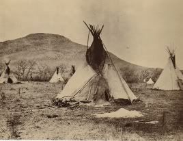
While surfing around, I found this picture. Can anyone tell me where exactly it is, and has anyone ever seen it before? tinyurl.com/2rhnnyThanks. (The link should work now. Merry Christmas! -- Diane) |
|
|
|
Post by bubbabod on Dec 21, 2007 10:31:38 GMT -6
Curses! I just looked at the attached link, and it says there is a problem. The picture was of a small cairn with a sign that said <"Custer camped here June 23rd." Although the date, due to the font is very unclear whether it's the 23rd or 25th. The person who posted the picture on "flickr" indicated it was on the 23rd. Sorry it didn't come out. But I know many of you have toured the area. Does anyone know of such a marker or where it was
Thanks.
|
|
|
|
Post by harpskiddie on Dec 21, 2007 16:58:15 GMT -6
Bubbabod:
When I tried the link, I also got the error or problem message, so I don't know what picture you are referencing. I can tell you, however, that there was a small cairn marking the 23 June campsite, on the east side of the Rosebud, a few miles north of Lame Deer. It is not right on the creek, but it's been so long since I was there that I can't recall the actual distances. There is a picture of it in one of the Weibert books.
I've just returned from a successful safari to one of my bookcases, during which I kicked over the cats' water dish. The picture is on page 18 of Four Days With Custer.
Gordie
MC
mauler of cat dishes
PS send money if this helps.............
|
|
|
|
Post by bubbabod on Dec 22, 2007 0:27:00 GMT -6
Gordie, thanks for the information. When I was on a trip out there years ago I'd heard of that marker, but never had time to look for it. I always thought it was in the Lame Deer area. Thanks so much for the info.
|
|
|
|
Post by Lawtonka on Jan 1, 2008 18:52:02 GMT -6
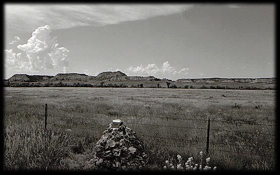 Hello, Happy New Year Frank and all! Hey here is a picture I took of the same marker. It is for the campsite of the 23rd of June 1876. To get there from the tiny town of Rosebud, MT, follow Hwy 447 South, the road runs beside and within site of the Rosebud all the way to the divide. This camp is 33 1/10 miles south from the Yellowstone Also of interest might be this .... When you leave I-94 at 6.2 miles south at the top of a hill you will find the Nathan Short Marker and at 3.5 miles is the campsite of the 22nd of June. Of course, the 23rd was the last real camp the 7th made as they only halted for a short while just before the divide at Davis Creek and rode on into battle on the 25th |
|
|
|
Post by WY Man on Jan 19, 2008 16:36:07 GMT -6
Hi Frank and everyone:
I am new here. Thanks to you Frank, I found this great board and I have joined.
That is my picture on Flickr that you ask about, Frank. Lawtonka comes to the June 23rd camp from the north, from I-94. I always come from the battlefield, on Hwy. 212, east to Lame Deer, and then turn north.
From Lame Deer on the Northern Cheyenne Indian Reservation, go north on Hwy. 39 about eleven miles, following the Rosebud River valley. It is a beautiful drive by the way. Be looking for the marker along the road to your left as you are driving northeast. I think it is near the 11-mile sign post, but I'm not sure on which side. Highway 39 will turn north after about 12 miles, where it continues to Colstrip. If you reach that turn in the road, you have gone past the marker. The marker is about a mile before the road turns north. The best map of this area is the BLM 1:1,000,000 topo map for Lame Deer, Montana. The Little Bighorn is on the adjacent Hardin BLM map.
|
|