Post by Mike Powell on Apr 15, 2023 13:18:47 GMT -6
My oldest son, Michael, and I hired Dennis Fox, excellent guide and brother of archaeologist and author Richard Fox, to lead us from Busby to the Crow Nest and the Divide along the route taken by the 7th.
I posted photos of such to this board later that year but Photobucket and I parted ways and the links to my photos were lost some time ago. Let's try it again with Flikr:
First off, the map. We were coming in WSW along Davis Creek on that double-dashed trail from the upper right. In lower half of the map there's a rough circle drawn by Dennis showing the area of the Nest, with the topographic lines at about the one o'clock of the circle indicating the way in to the Nest's bowl.
 Halt Map by Mike Powell, on Flickr
Next, taken from the 7th's second halt on their approach, my son and I indicate between our fingers the distant Crow Nest.
 P1000306 by Mike Powell, on Flickr
Here is the view at the entry into the bowl of the Nest. The trail leads forward and then to the right as you climb curving up the west side of the bowl. This view is headed about SW.
 P1000313 by Mike Powell, on Flickr
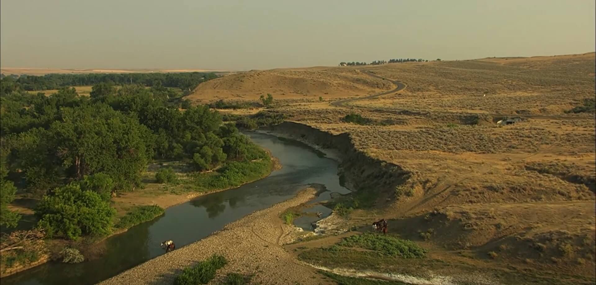
And here from the same point, the view NNE looking toward the Davis Creek valley from which we had come.
 P1000307 by Mike Powell, on Flickr
Then climbing the track toward the upper west edge of the bowl, as you near the high point, the Wieburt Marker, elevation 4,387 ft, N45 26.808, W107 08.393:
 P1000320 by Mike Powell, on Flickr
 P1000321 by Mike Powell, on Flickr
About 100 yards back the track, below the marker, is the location of the well known 1919, White Man Runs Him photo with General Hugh Scott, elevation 4,359 ft, N45 26.856, W107 08.362:
 P1000341a by Mike Powell, on Flickr
 P1000341 by Mike Powell, on Flickr
These photos look back to the NE and, if you walk across the track, your view will then be WNW toward the area of the pony herd on the uplands above the great village. (The village site of course is hidden from view by the bluffs rising on the east of the Little Horn.) I believe that spot, that view is where the scouts said to look for "worms crawling on the ground" (as Boyer interpreted to Varnum), meaning the perceived movement of the herd as it grazed. Dennis told us he'd been there once when a rancher's combine was cutting off on that land and it was clear to the eye.
 P1000340 by Mike Powell, on Flickr
The pony herd area lies just right of the darkest tree top just left of center, the tree top which just touches the farthest horizon.
Here's the view taken at 6X.
 P1000335 by Mike Powell, on Flickr
The dark tree top is now prominent at the center of the image and the pony herd area is around that faint strip of light cultivated land extending to the right from the very top of the tree. Fairly clear day but some distant haze, about 1:00 PM MDST.
Finally, here's that view again but considerably more magnified:
 P1000334 by Mike Powell, on Flickr
As I said, a theory I owe to Dennis Fox of where Varnum's lookout occurred, based in part on the idea that WMRH took the Scott party up the slope as far as needed to get to the point he remembered and the 1919 photo was taken at the same elevation. It's not in the immediate marker vicinity and it's not the highest point on the hill (neither is the marker). If you believe old men would go no higher than necessary, I think it has some merit.
Best regards,
Mike Powell
I posted photos of such to this board later that year but Photobucket and I parted ways and the links to my photos were lost some time ago. Let's try it again with Flikr:
First off, the map. We were coming in WSW along Davis Creek on that double-dashed trail from the upper right. In lower half of the map there's a rough circle drawn by Dennis showing the area of the Nest, with the topographic lines at about the one o'clock of the circle indicating the way in to the Nest's bowl.
Halt Map by Mike Powell, on FlickrNext, taken from the 7th's second halt on their approach, my son and I indicate between our fingers the distant Crow Nest.
P1000306 by Mike Powell, on FlickrHere is the view at the entry into the bowl of the Nest. The trail leads forward and then to the right as you climb curving up the west side of the bowl. This view is headed about SW.
P1000313 by Mike Powell, on FlickrAnd here from the same point, the view NNE looking toward the Davis Creek valley from which we had come.
P1000307 by Mike Powell, on FlickrThen climbing the track toward the upper west edge of the bowl, as you near the high point, the Wieburt Marker, elevation 4,387 ft, N45 26.808, W107 08.393:
P1000320 by Mike Powell, on FlickrP1000321 by Mike Powell, on FlickrAbout 100 yards back the track, below the marker, is the location of the well known 1919, White Man Runs Him photo with General Hugh Scott, elevation 4,359 ft, N45 26.856, W107 08.362:
P1000341a by Mike Powell, on FlickrP1000341 by Mike Powell, on FlickrThese photos look back to the NE and, if you walk across the track, your view will then be WNW toward the area of the pony herd on the uplands above the great village. (The village site of course is hidden from view by the bluffs rising on the east of the Little Horn.) I believe that spot, that view is where the scouts said to look for "worms crawling on the ground" (as Boyer interpreted to Varnum), meaning the perceived movement of the herd as it grazed. Dennis told us he'd been there once when a rancher's combine was cutting off on that land and it was clear to the eye.
P1000340 by Mike Powell, on FlickrThe pony herd area lies just right of the darkest tree top just left of center, the tree top which just touches the farthest horizon.
Here's the view taken at 6X.
P1000335 by Mike Powell, on FlickrThe dark tree top is now prominent at the center of the image and the pony herd area is around that faint strip of light cultivated land extending to the right from the very top of the tree. Fairly clear day but some distant haze, about 1:00 PM MDST.
Finally, here's that view again but considerably more magnified:
P1000334 by Mike Powell, on FlickrAs I said, a theory I owe to Dennis Fox of where Varnum's lookout occurred, based in part on the idea that WMRH took the Scott party up the slope as far as needed to get to the point he remembered and the 1919 photo was taken at the same elevation. It's not in the immediate marker vicinity and it's not the highest point on the hill (neither is the marker). If you believe old men would go no higher than necessary, I think it has some merit.
Best regards,
Mike Powell