|
|
Post by Dark Cloud on Sept 1, 2009 9:35:58 GMT -6
It's the graphics that lend a tone of competence otherwise absent. conz has discovered this tendency, and few notice right off how bogus his graphic descriptions are either.
Here, the description of the Garry Owen Loop's life isn't what I've read, nor does it make any sense. The conclusions from the photos, as BC notes, are bogus on their face, but the crux is this: we're to believe LSH is false? That all the activity that surrounds it is false? The bones, the markers, the photos? The testimony, the accounts, the history?
Let them write a book. My review is ready.
|
|
|
|
Post by wolfgang911 on Sept 1, 2009 15:29:56 GMT -6
It's the graphics that lend a tone of competence otherwise absent. conz has discovered this tendency, and few notice right off how bogus his graphic descriptions are either. The conclusions from the photos, as BC notes, are bogus on their face, you jump in into a noard that is new to you, do your homework, what do you get ; bogus, incompetence Dc you're the rudest bastard i've ever met on the internet. can't you just exhcnage with someone. You're killing this board crushing everyone. For once there is a new poster since I joined some months ago and you sacre this game off buttmunch don't make me smack your f |
|
|
|
Post by wolfgang911 on Sept 1, 2009 15:30:30 GMT -6
ace again famous line of beavis and butthead is what comes up when i read you
|
|
|
|
Post by wolfgang911 on Sept 1, 2009 15:35:14 GMT -6
Oups these went of sorry : well at least it is proof of my spontenaousness, this silly post reads : It's the graphics that lend a tone of competence otherwise absent. conz has discovered this tendency, and few notice right off how bogus his graphic descriptions are either. The conclusions from the photos, as BC notes, are bogus on their face, You jump in into a board that is new to you, you do your homework, and what do you get ; bogus, incompetence! Dc you're the rudest bastard I've ever met on the internet. can't you just exchange with someone. You're killing this board, crushing everyone. For once there is a new poster since I joined some months ago and you scare this game off! Buttmunch don't make me smack your face again, famous line of beavis and butthead that comes up when I read you i'm glad heroesrest is on here, thanks |
|
|
|
Post by herosrest on Sept 1, 2009 19:09:23 GMT -6
Hi bc. Book - No. Hobby if you like. Fame or wealth, not my thing. It isn't a confidence matter either, this topic - LBH in general will teach those who
don't already know, that we all make mistakes. Some of of them as big as the moon. Serious and dedicated people have devoted lifetimes to this event,
'what more is there to say'.
If that is the side slope of cemetary ridge then so be it, whenever l view the period photographs and compare with modern shots, a little bell rings and
says woa! It's that simple. There are other pics as well. A couple of D.F. Barry's from 1886. A lot of people today visit and study that place, they know
what they are doing and know what they mean. The same applies to those 130 years ago. There is no reason to ignore or diminish Norris and it is a
reasonable place to start in terms of the lay of the land back then. Maguire simply didn't have the time for a thorough work. The terrain and particulrly
horizons, cannot be taken for granted, the imposition of different terrain to horizon views, as points of observation change is a guarantee of what a
picture is looking at, not so at LBH. There are repeats of features throughout the terrain and stretching to horizons that mislead. The terrain plays
tricks upon close scrutiny.
Access to the river by Deep Ravine according to Norris was not possible. Morrow's picture and Norris re-inforce the matter. Thare are some
implications therefore for access to the battlefield and The right Wing scouting for a way into the valley. For the life of me l can't place the Morrow shot
of the bluffs, let alone work out where he took it from, unless he had wings.  He was as interested in turning a buck as the actual content of the work. He was as interested in turning a buck as the actual content of the work.
That's the way of it and there are no detailed reports to accompany his work. He took his snaps and looked to sell them on. It was the beginning of the
commercialisation of the battle, which quite rightly, continues today and introduces influences.

I cannot fathom where the Morrow cliffs shot was taken from. You're one up on me.
Morrow's statements about drownings in the river is awkward, other record indicates this occured with single troopers towards the close of fighting and
with guys after a drink at Reno Hill. Sgt. Botzer was found at/in the river bank and a half dozen or so troopers killed retreating the timber were found lying washed up on a gravel bar in the water, another trapped under his dead horse in the water. Red Hawk adds a further aspect. Neither had reason to mislead,
both records are frustrating. Those cliffs actually look as though you could simply run off them in panic, flat out, looking behind over a shoulder.
There's nought mysterious on my part, l find LBH is run through with mystery and challenge and some huge ego's. Stubborn views, stubborn minds.
That's cool. There is a time problem with events of the battle, many have dealt with it, none of it works for me. That isn't anything of great concern but
gaining a real understanding of how the terrain was then, and what was and wasn't possible should prove a boon to 'Many People'.
|
|
|
|
Post by herosrest on Sept 1, 2009 19:31:11 GMT -6
Hi darkcloud, Primary sense is sight, it makes things easier, beyond that a matter remains down to personal
interpretation. That you are shown something is no guarantee what so ever that it will be accepted.
Besides issues l see with locations assigned to some of the period photographs, l am implying nothing revolutionary.
Combat occured at LSH and all over that battlefield. A lot of effort has and is involved with events down to micro
management level. 'Following' such analysis, l haven't found any that stand up. That isn't the point though, here.
Those pictures are not of LSH. The events of the battle are one thing. Troopers or braves didn't take these
photographs or analyse them. Different thing, chalk and cheese. No one understands properly the lay of the land and
yet the battle is detailed down to the last minute. Was it actually possible in 1876 to get down to the river at Ford D.
Well obviously not via Deep Ravine or getting up from the river either.
Warrior record and Norris's map agree events that took place.
"The great enemy of the truth is very often not the lie - deliberate, contrived and dishonest - but the myth: persistent, persuasive and unrealisitic."
|
|
|
|
Post by herosrest on Sept 1, 2009 19:48:01 GMT -6
Yo wolfgang911 - Thanks for the support. I carry my own thunder. Regards. ;D
|
|
|
|
Post by bc on Sept 2, 2009 0:31:33 GMT -6
Herosrest: I'm following you here. You may well be on the right track. One of the keys here may well be placing the Morrow cliff photo. You didn't identify the ravines in the sat photo you posted above but there are cliffs in it similar to Morrow's. Is one of those deep ravine and/or cemetery ravine? I haven't really been at the river below deep ravine and Sandy didn't say where he took the duplicate photo in his Where Custer Fell book on page 121. I didn't say I could identify that particular Morrow photo though. As Sandy said no one has an explanation for what Morrow said and did. Did he, Norris, and Sanderson know some things they just didn't pass on to others?
If you look at your close up of the picture in reply #1, off to the right of the river bend up on the benchlands, you see a U notch cut down in the bench lands. When you look behind the Sanderson camp photos, what appears to be the same cut down is there. Same for when you look at the wickiup photo. Go back to your photo in reply # 1, and put a camera on the left side of the camp close to the south river bank and back east from the camp, you then have the camp with cut down in the background. Now move that camera west of the tents while still viewing inside your blue box to where the camera is pointed over the clear space in the trees and over the river looking at that notch and you have your wickiup photo. Now look behind the tents in the camp photo about a hundred yards, is that the wickiup? All of this would take some fine photo analysis beyond my 20/200 vision but there is some resemblances. You would probably have to do a mirror image analysis just in case someone reversed the images when printed ala the left handed gun and Barry's 1886 photos. As an aside, I thought maybe the camera location for the camp photos may be the same spot for the ford photo with the camera spun around and looking south. However, it is hard to tell by the differing angles and my vision but there is also the possibility that the ford is located behind the camp and towards that possible wickiup object. There are really some odd shaped and angled trees in the ford photo that could possibly be on the southwest side of the wickiup object but it would take some type of microscopic computer analysis to look for a match. Food for thought anyway.
After you do the further photo analysis on the horse skeleton hill photos and possibly mirroring those in case they were printed bass ackwards, then you can start on the others.
As an aside, you made me look at the Sturgis and Keogh photos a lot closer the other night, as well as the other photos including Barry's, and I have reached the conclusion that the ground around there was just sparsley covered with sage brush/vegitation and would be very conducive to making dust when riding over it. With the mild northerly winds that day, there wouldn't be huge rooster tails of dust, but quite a lot of dust nonetheless. Enough that it wouldn't be fun riding at the back of the column.
I was just kidding about the confidence issue. I know enough to be dangerous and enough to be a devl's advocate but not enough to have any type of locked in opinion of what happened. For your information, I spent a few hours yesterday copying and printing a few hundred items off your website. I've skimmed over enough of it to know where you are going so there is no more mystery there. However with any theory, the devil is in the details and it is something that can only be fleshed out over time(too much to discuss at once). And alot of it is going to require your explanation for me to properly follow it. The reason I asked about the book is because you have spent alot of time doing your analysis and putting together your graphics so I figured you were writing a book or doing power point presentations. Really fascinating stuff.
Still wondering where you have ford C, the topic of this thread. Is it at what I call the Realbird ford or further north? I'm guessing you have it in the Calhoun coulee area but I don't know what that terrain is like by the river. May need a sat photo of that area as well. The Calhoun coulee area would still be north of the Cheyenne circles and still match up with Squaw Creek. It would help to find 28 bodies in it somewhere.
bc
|
|
|
|
Post by herosrest on Sept 2, 2009 6:48:12 GMT -6
Hi, bc. The image is a tiny distance below Realbird. There honestly isn't enough detail or
width of view to pin anything down. Terrain features are obscure and the nature of the
place repeats features endlessly. The 'anomoly is tantalising, being only in the one frame.
The sun may have gone in, between snaps, many possibilities. The cavalry side of the fight
that day was based in military tactics and some of what l read is unreal enough to irk.
Life gave me time on my hands for a while and here l am. People hate to make public
mistakes, l am no different but will live with it if l have to. l don't consider where i'm at
as high risk. Here's why.
I altered my views of village size some time ago and realised mountains of opinion and
research is simply flawed in thinking and or process which has accumulated since 1876.
Lt. Clark's map, shows the village as it was in 1877. Clarks map of the battle tells a different
story when viewed with modern understanding of village size.
Clark's map - www.friendslittlebighorn.com/williamclarkmap.jpg
The Cheyenne are near the Ford B, that is what is illustrated because that is the way it was.
Somehow because Clark labelled a ford as D, confusion reigns and that crossing place is taken
as down river at and beyond Deep Ravine. The Cheyenne were camped opposite MTC or
Deep Coulee and that is what the map shows. 133 years ago the village was accepted as 4 miles
long and on it rolls, fiction as fact. There were two hills, all focus falls on LSH. Clark knew
something wasn't right but common knowledge was a village miles long.
Ford B area files.myopera.com/herosrest/albums/634358/10033393.jpg
Clark's map does't make sense in the modern context - it does not relate to terrain or
events as understood. The understanding is incorrect, not the map. Comparing Clark's work
with that of W.P. Norris are there similarities in the terrain. They confuse and tell a story
different to the accepted ideas. The accepted ideas are incorrect not the record of
an invividual present in 1876. Clark's informant provided detail from memory, Norris was
on site doing his work. There are similarities between the two if you throw away accepted
perceptions.
Not all warriors who fought Calhoun, Oglala amongst them went on to LSH. Some stayed at Calhoun, others
returned to the valley and others yet, tangled with Edgerley. 'The Taming of the Sioux' by Frank B. Fiske. Oglala warrior - 'Paints Brown'.

These works were by people of the time, at and about the place.
Here is a little known picture that shows an interesting view of terrain. It is priceless.
www.digitalhorizonsonline.org/cdm4/item_viewer.php?CISOROOT=/uw-ndshs&CISOPTR=674&CISOBOX=1&REC=10
and one of the Ford and mouth of MTC. files.myopera.com/herosrest/albums/634358/10033393.jpg[/color] ______________________________________________________________________________________________________________________________It all stems, (possibly  ) from a sombre, haunting and artistic photograph, that became world famous, an icon. ) from a sombre, haunting and artistic photograph, that became world famous, an icon.
A revolution was taking place with media and photography. It is a huge part of this battles history and fact.
Seeing, is believing and that is enough, most of the time and particularly when, the object of interest will
never be seen first hand because it is several thousand miles or half the world away.
darkcloud's signature may be on the money with this one.
"The great enemy of the truth is very often not the lie - deliberate, contrived and dishonest - but the myth: persistent, persuasive and unrealisitic."
These views don't solve LBH mysteries, far from it, they amplify problems by orders of magnitude.
|
|
|
|
Post by herosrest on Sept 2, 2009 8:38:50 GMT -6
bc. re the 'U notch cut down in the bench lands'.
It is a significant background feature that helps to pin down the shots. It resembles a clenched knuckle or Lion's paw
and is poorly defined other than shadow form. It is a significant and identifiable feature but alters very subtly as
the angle of view changes. It is not the only creek breaking into the west face of the valley.
The terrain plays tricks in the period photography.
It is a pity Bob Reece was not around back then, l am a great fan, he is a skilled artist with a real feel and intuition for that land.
I cannot look at those Morrow pics and a couple of D.F. Barry's also without huge doubts as to the locations assigned them,
every time, every time l see them is the same response, an anguish.
Anyways............ here's my fave, the mutt's nuts, brilliant picture. www.friendslittlebighorn.com/lsbb02051.jpg
|
|
jody
Junior Member

Posts: 53
|
Post by jody on Sept 2, 2009 17:33:44 GMT -6
Herosrest, you mention not being able to see the Keogh area from Weir point and I think you said the fords - B and Realbird - can't be seen from Weir either. Do you have photos that show this?
It bears on another subject that I'm reviewing. Thanks!
|
|
|
|
Post by Dark Cloud on Sept 2, 2009 18:18:24 GMT -6
First, neither Norris' nor MacGuire's is a map. It is not to scale. Start with that. If you believe they record all bends of the LBH - a leap of baseless faith - they aren't to scale either. Reno's position was not a mile long. Sharpshooter Hill exists. Shown either map, without markings and writing, nobody would recognize it as Custer's and Reno's field.
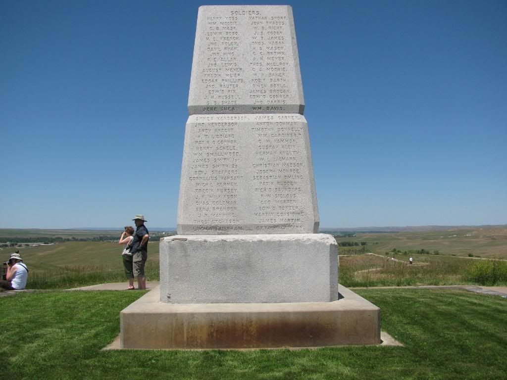
Second, given the testimony of the officers who revisited LSH after the battle at one day and ten years, they agree on the location of where the bodies were found on LSH. The view from Calhoun Hill is not that of LSH, and your revelations aren't. Fouche knew where he was even if told only that Custer was buried at the grouping furthest north. He would have been better informed than that. The wooden markers reflect nothing at Calhoun Hill by testimony or early photo.
The overpowering unimportance of where the fake grave for Sturgis was defies comment.
|
|
|
|
Post by herosrest on Sept 2, 2009 22:07:04 GMT -6
Hi darkcloud. Bewell.
Second. Norris and Maguires maps are maps, good enough for anyone to navigate by.
Third. l've not said or intimated a thing about who died where or didn't. I agree Custer died and it probably didn't bother him where it took place, Officers, the Custer family were moved to communal graves on the battlefield, the Captain & Lt. Colonel being placed side by side in the same spot.
It's beyond the issue of which hill, the hill is a photograph of.
A photographer took some pictures and published them. Quite some fun and games took place meeting the demand which developed for pictures LBH, of any significance. The first photographs of Gall, were taken by D.F. Barry. The pictures are quite famous in their own right as the first and the agrandisement afforded Gall after his surrender. He was quite a guy and influenential. Barry's done his thing, popped a couple of snaps and Galls had second thoughts when he visited to see the finished article and wanted them destroyed. Barry had no intention of giving up a nice little earner, so there they were - face to face knife and gun drawn. They compromised, Gall probably got a better price and the pair of them became friends over time. Both attended the 1886 anniversary and spent quite some of the day together.
l've said that photograph is not of LSH. Not a word have l said about Custer. So, the man had two gunshot wounds, some Lacota say three. Cheyenne warriors, three of them were stuck all afternoon, guarding his body until dusk, although, no one actually recognised him. He may have been shot on LSH, though there is not a single marker on it and warriors did state troopers were killed on that hill. Many Custers died that day. At the river, and all over the battlefield. Benteen went over there with Company H on the 27th, as soon as Terry showed up. No one will ever work it out. Where Custer was wounded, where he died, who killed him or how it happened. The first word that arrived back at Fort Lincoln was that he shot himself. If l was Custer, incapacitated with a wound on that battlefield and about to be overrun, l would shoot myself and so probably quite a few people. That takes courage. But l said nothing about Custer.
There isn't a rational reason to discredit Norris or his sketch. Its that simple. The scale is actually pretty good. The loop shown in the photograph is therefore not below Last Stand Hill. It was very easy for a misunderstanding such as that to occur. Part is simply the plethora of different names that existed and have been applied to features of the terrain. Part was the totally limited number of people able to go see for themselves which brought about huge demand for pictures. A very simple confusion, the type of thing that occurs all the time. Misunderstandings.
As for the photographer knowing where he was, not even that is clear cut is it, there weren't sign posts up at the time. Posts marking graves yes but they didn't get Custer's remains the first time they dug someone up, there was a corporals shirt underneath the body and officers running around wet nursing photographers just didn't happen, they were busy.
|
|
|
|
Post by herosrest on Sept 2, 2009 22:13:58 GMT -6
|
|
jody
Junior Member
Posts: 53
|
Post by jody on Sept 3, 2009 0:11:52 GMT -6
Hi back at you, Herosrest.
Thanks for the links. The second one, from Weir, shows Custer Hill clearly, no Keogh - as you said, and what looks like Calhoun hill. Am I right? Is the Finley/Finckel area visible?
You've got questioning each and every land feature in every photo now, btw.
The first link does indeed show the ford, but from much closer than Weir, I think. Great to have though.
Does anyone have photos or can point me to a source, a thread or online or a book, of what can be seen from Weir ie the the ford(s), camp/valley, coulees, etc. ?
What I'm trying to determine is what Custer could see from Weir, if he was there.
And perhaps shots from Custer's Look (or what ever it's called). That point on the bluff where he could have spied out the valley prior to Weir.
Thank you for the Morrow photo. Your posting shows the marking stakes much more clearly than in my copy of "Where Custer Fell". It is appreciated from one who has taken Dark Cloud's admonishmet to count them himself.
In your pic with the blue box. You say that shows a logging operation. In WCF they indicate that the white specks in the upper left corner are the wagons and tents of Capt. Sanderson's camp. He who's job it was to "tidy up" the battlefield. Morrow traveled with him. WCF also shows pics of the camp Morrow took on site. The black line and elongated rectangle are, I think, the far banks of the river in deep shadow.
Jody
|
|


 He was as interested in turning a buck as the actual content of the work.
 ) from a sombre, haunting and artistic photograph, that became world famous, an icon.